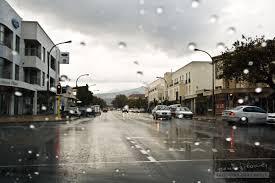
The South African Weather Service (SAWS) has warned of a potent cold front sweeping across the country midweek. The system is bringing a complex mix of heavy rain, highland snow, damaging winds and even veld fire risks due to erratic, dry gusts in the interior regions :contentReference[oaicite:2]{index=2}.
The front arrives Thursday, impacting the Western Cape, Cape Winelands, and West Coast with heavy rain and local flood warnings As it moves eastwards, the Eastern Cape will also experience showers.
By Friday, snow and sleet are predicted over high-altitude areas of the Drakensberg Highlands, Gauteng and high-lying parts of Mpumalanga
Expect early showers to fade over the northeastern provinces (Free State, KwaZulu-Natal) and a slow rebound from cooler daytime temperatures over the weekend

A recent Reuters report confirmed that the front already caused a fatal crash on the N2 highway, power outages affecting over 300,000 households, road closures in the Eastern Cape and KwaZulu-Natal :contentReference[oaicite:10]{index=10}.
The Free State MEC also cautioned farmers about snow, strong winds, and risk to livestock—advising shelters and caution with open flames during veld fire season :contentReference[oaicite:11]{index=11}.
Heavy rainfall may flood low-lying areas and overflow storm drains. Travel advisories and flood warnings remain in effect :contentReference[oaicite:12]{index=12}.
Expect strong winds and persistent rain. Coastal areas and informal settlements should watch for wind damage :contentReference[oaicite:13]{index=13}.
Prepare for a chilly drop in temperatures and potential snow or sleet Friday morning—especially in high-altitude suburbs :contentReference[oaicite:14]{index=14}.
Gusty wind conditions and dry vegetation increase the threat of veld fires—authorities recommend high alert :contentReference[oaicite:15]{index=15}.
South Africa’s winter is dominated by periodic cut-off low systems—these heavy, cold air masses form over the Atlantic and bring multifaceted hazards :contentReference[oaicite:17]{index=17}. Mountain snowfall often cascades into broader weather disruption across the interior and costal plains :contentReference[oaicite:18]{index=18}.
As the season progresses, SAWS forecasts alternating cold fronts. It’s vital authorities and residents remain alert with better early-warning systems and public readiness :contentReference[oaicite:19]{index=19}.
Explore more weather coverage: Today’s Weather Updates, South African Winter Snow Patterns.
For authoritative guidance, visit the SA Weather Service and keep tabs on News24 Weather.
Learn more about the broader flood impacts in June 2025 at the 2025 South Africa floods page.
for more news visit our website
this post by news24.chttps://www.news24.comom