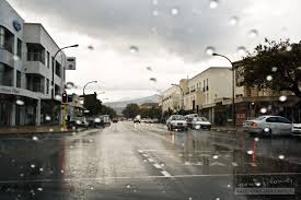
The South African Weather Service (SAWS) has escalated warnings for the Eastern Cape, forecasting persistent and potentially damaging waves and winds along the coast for Monday. While the Eastern Cape bears the brunt of severe conditions, much of South Africa wakes to a distinctly chilly and cool start to the week, with light rain expected in the Western Cape and frost threatening inland areas.

The primary weather focus remains firmly fixed on the Eastern Cape coastline. SAWS has issued a Level 4 Yellow Warning for damaging winds and waves, urging residents and mariners to exercise extreme caution.
Damaging Winds: Strong north-westerly to westerly winds, gusting between 50-60 km/h, are expected along the coast between Gqeberha (Port Elizabeth) and East London. These winds pose a significant threat:
Damaging Waves: The powerful onshore winds are whipping up treacherous sea conditions:
Residents in coastal communities from St Francis Bay to Port Alfred should secure property, avoid coastal promenades, and heed local authority instructions. Mariners MUST stay in port.
While escaping the severe coastal battering, the Western Cape sees a shift:

The cold front influencing the south has ushered in crisp air across much of the country:
Highveld (Gauteng, Mpumalanga Highveld, Free State): Expect cool, dry, and sunny conditions. Morning temperatures will be particularly brisk, hovering in the low single digits in many areas. Johannesburg and Pretoria will see highs around 17-19°C. Frost is possible in low-lying areas of the Free State and Mpumalanga on Monday night.
KwaZulu-Natal: Mostly fine and cool, though slightly warmer than the Highveld. Coastal regions (Durban) will be pleasant with highs near 22°C, while the interior Pietermaritzburg area reaches around 20°C.
Northern Provinces (Limpopo, North West): Fine, sunny, and cool to warm. Frost risk is minimal here.
Interior (Karoo, Northern Cape): Very cold mornings are the highlight, with widespread frost expected. Daytime will be sunny but remaining cool. Sutherland and similar high-lying areas could see early morning temperatures well below freezing
Eastern Cape Coast:
The Bigger Picture: Climate Variability and Coastal Vulnerability
While individual weather events cannot be directly attributed to climate change, the increasing frequency and intensity of coastal storms and damaging wave events align with projections for Southern Africa. Rising sea levels also exacerbate the impact of storm surges and coastal erosion. The Eastern Cape coastline, with its mix of urban development and sensitive ecosystems, is particularly vulnerable. Events like today’s highlight the critical need for:
Enhanced Coastal Management: Strengthening infrastructure, enforcing building setbacks, and protecting natural buffers like dunes and wetlands. [External Link: DEFF Coastal Management Programme]
Robust Early Warning Systems: SAWS plays a vital role, but community outreach and understanding of warnings need continuous improvement.
Climate Adaptation Planning: Coastal municipalities must integrate climate risks into long-term planning and disaster management strategies

The damaging winds and waves in the Eastern Cape are expected to gradually subside from late Monday into Tuesday. However, cool to cold conditions will persist across the interior for the next few days. Another cold front might approach the Western Cape towards the end of the week, potentially bringing more rain and reinforcing the chill
For the very latest, minute-by-minute warnings, and detailed forecasts for your specific location, always refer to the official South African Weather Service (SAWS) website and app. News24 will continue to provide comprehensive coverage of significant weather developments impacting South Africans
Thanks for reading for more news visit our website
For more weather news SAWS Official Website
This post by news24.com